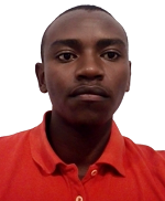
Mr. Simon Muthee
Designation: MSc. Research Assistant
School/Institute: Institute of Geomatics, GIS and Remote Sensing (IGGReS)
Centre: Remote Sensing Research Group (RSRG)
Email: simonmuthee26@gmail.com
Academic Background
| Qualification | Institution | Year |
|---|---|---|
| MSc. Geospatial Information Systems & Remote Sensing. | Dedan Kimathi University of Technology | 2023 |
| BSc. Geospatial Information Science | Dedan Kimathi University of Technology | 2017 |
Areas of Expertise
- Geospatial Engineering
- Remote Sensing
- Engineering Surveying
- Geodesy
- Environmental Modelling
Publications
- Muthee, S., Kuria, B., Mundia, C., Sichangi, A., Kuria, D., Wanjala, J., Kipkemboi, W., Goebel, M., Graw, V., &Rienow, A. (2023). Using the SARIMA model to predict the trends of evapotranspiration and runoff in the Muringato river basin, Kenya. Stochastic Environmental Research and Risk Assessment, 1–12. https://doi.org/10.1007/s00477-023-02534-w
- Kipkemboi, W., Kuria, B. T., Kuria, D. N., Sichangi, A. W., Mundia, C. N., Wanjala, J. A., Muthee, S. W., Goebel, M., & Rienow, A. (2023). Development of a Web-GIS Platform for Environmental Monitoring and Conservation of the Muringato Catchment in Kenya.. Journal of Geovisualization and Spatial Analysis, 7(1).. https://doi.org/10.1007/S41651-023-00143-3
- Muthee, S. W., Kuria, B. T., Mundia, C. N., Sichangi, A. W., Kuria, D. N., Goebel, M., & Rienow, A. (2022). SWAT to model the response of evapotranspiration and runoff to varying land uses and climatic conditions in the Muringato basin, Kenya Modelling Earth Systems and Environment. . https://doi.org/10.1007/S40808-022-01579-0
Conference Papers/Presentations
- Characterising the Changes in Land Use and Land Cover (LULC) amid Changing Climatic Conditions using Remote Sensing Techniques in the Muringato Basin, Kenya- 41st EARSeL Symposium, Cyprus. https://cyprus2022.earsel.org/assets/BookOfAbstracts.pdf
Awards, Scholarships and Recognitions
- MSc Scholarship and Research Sponsorship by the German Federal Ministry of Education and Research (BMBF) under the project “CITGI4Muringato (grant no. 01DG20022)”.
Other Academic and Professional Achievements
-
A. Completed Research
- Participatory Approach to Environmental Conservation of the Muringato Catchment Area for Sustainable Management and Enhanced Ecosystem Health.
Research Interests
- Environmental modelling
- GIS and Remote Sensing
- Hydrological modelling
- GIS programming
- Geostatistics
- GNSS Positioning and Mapping
- Engineering Surveying
