Participatory GIS Tool for Environmental Conservation (PGIS)
Project details:
Monitoring and protecting the environment is a major goal
for various stakeholders due to the continuous degradation by
anthropogenic factors and climate change occurrences.
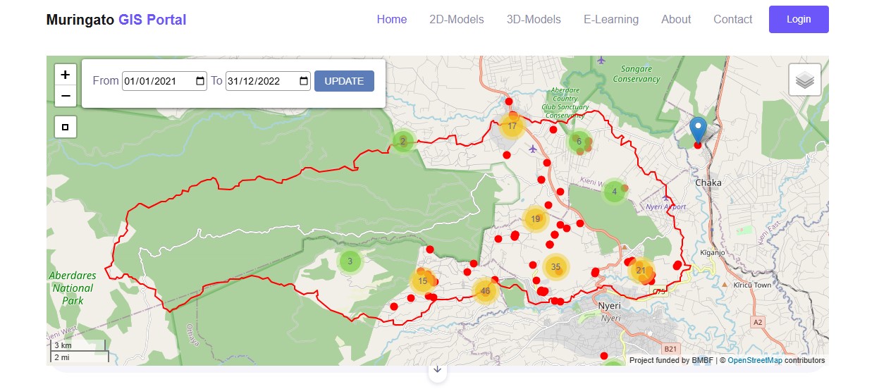
Developing web-based geographic information system (GIS)
platforms have been proposed as one environmental monitoring
tool because of their easy operability, accessibility, and ability
to present data. A web-based GIS platform developed from Django and
GeoDjango frameworks and PostgreSQL database was deployed for the
Muringato catchment to aid in the visualization of near-real-time
environmental degradation incidents reported by the local community.
The web-GIS platform interface comprised a legend categorized
according to the incident type and other functionalities including
clustering, zoom in/out, pop-ups, and query to aid end-user interaction
with the visualized data. The web-GIS platform provided a platform
with near-real-time data to engage various stakeholders for the
collaborative conservation efforts of the Muringato catchment.
You can access the Application from the following link: Muringato PGIS
Project information
- Category Research
- Sponsor German Federal Ministry of Education and Research (BMBF)
- Project"CITGI4Muringato " (grant no. 01DG20022)
- Project Status Completed